|
|
Post by Jester_ on Feb 17, 2010 21:48:59 GMT -7
Entrance to Anchorage Farm Road on Route 29, Virginia Morgan Harrington was found 1.5 miles, by road, into the property. 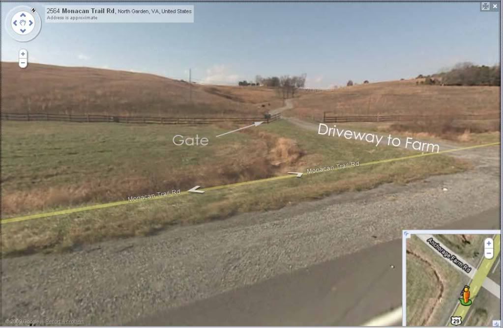 |
|
|
|
Post by Jester_ on Feb 17, 2010 22:17:03 GMT -7
Location of Main house at the end of the driveway. This is where Mr Bass and his wife life. 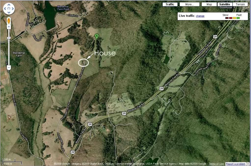 |
|
|
|
Post by Jester_ on Feb 17, 2010 22:17:51 GMT -7
Close up aerial view of the house. 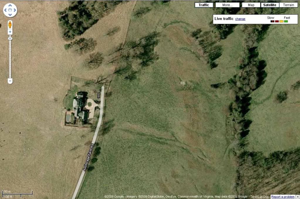 |
|
|
|
Post by Jester_ on Feb 17, 2010 22:23:51 GMT -7
Original Homestead is on the same road, closer to Route 29. Houses are marked with a red circle. We first thought that Morgan was found in the area marked by the two dots, but she was found a few feet west of that location. 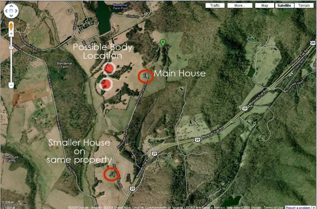 Approximate property line. 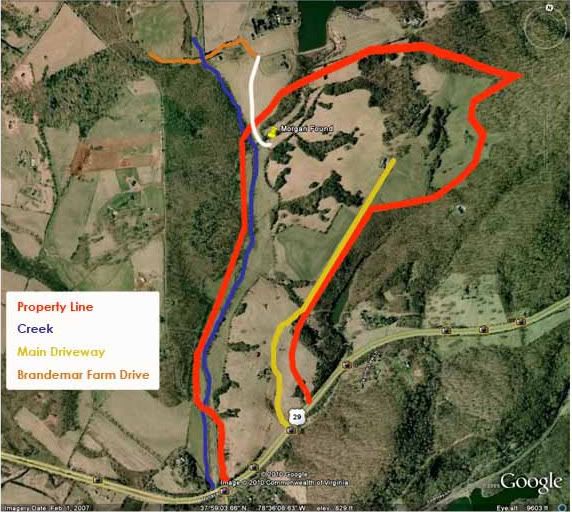 |
|
|
|
Post by Jester_ on Feb 17, 2010 22:29:46 GMT -7
The area around Chopin Road was mentioned early on as a point of access to the farm. 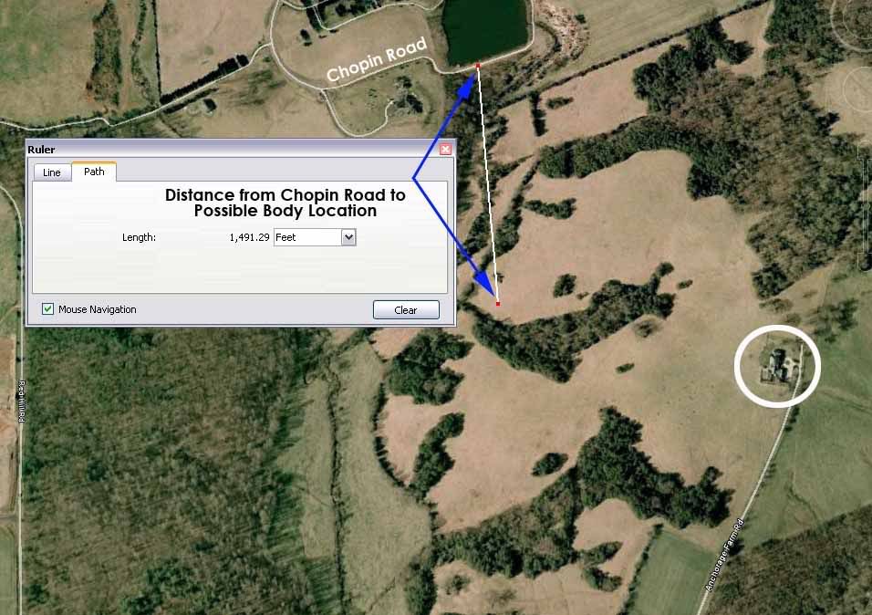 |
|
|
|
Post by Jester_ on Feb 17, 2010 22:30:44 GMT -7
Actual location where Morgan was found. 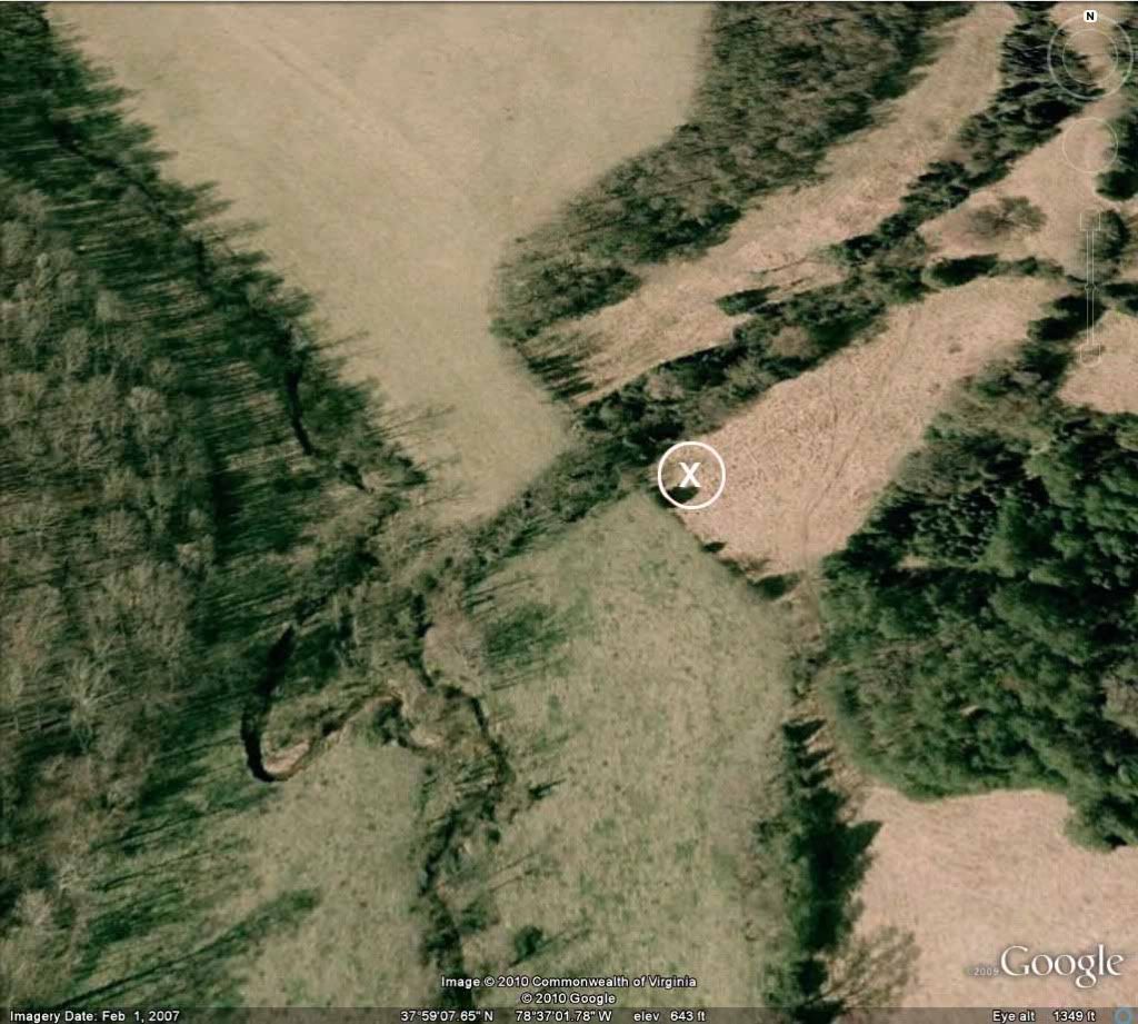 Crime scene photo 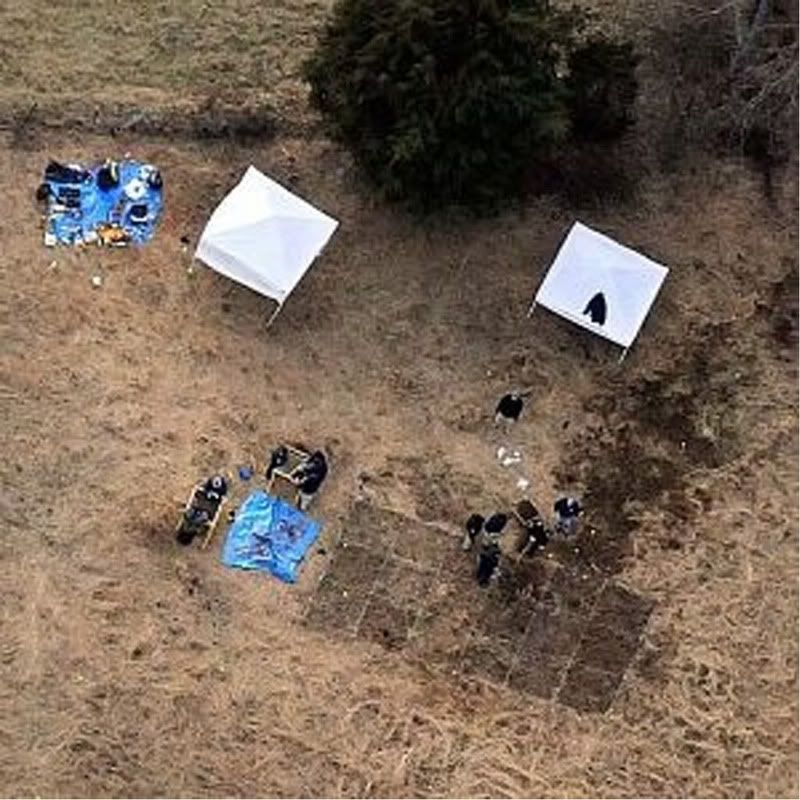 Distance gauge 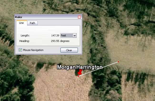 |
|
|
|
Post by Jester_ on Feb 17, 2010 22:35:03 GMT -7
Approximate distance from Morgan to possible entrances to the farm - via trespassing. 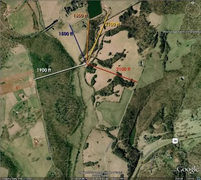 |
|
|
|
Post by Jester_ on Feb 17, 2010 23:06:56 GMT -7
Morgan body location. 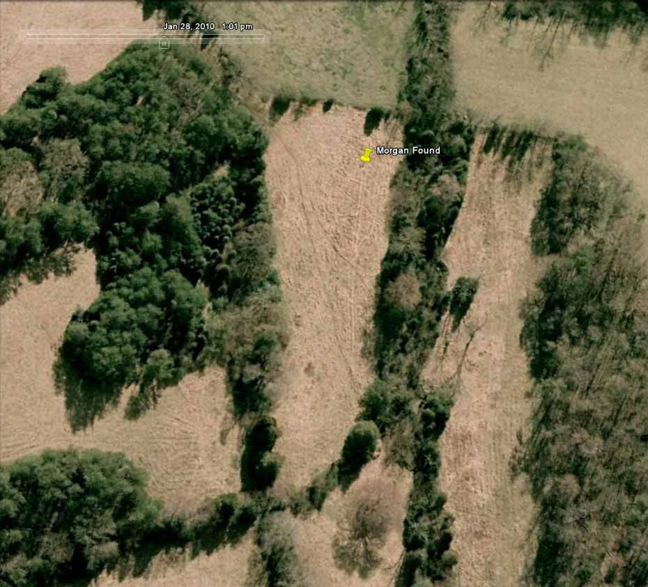 |
|
|
|
Post by Jester_ on Feb 17, 2010 23:08:23 GMT -7
Location of Morgan in Relation to Blandemar Drive, and unoccupied building associated with the new property/house on Waldemar Drive. 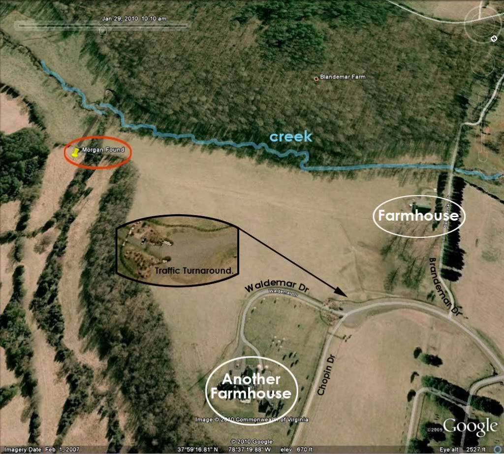 Close up of the farmhouse, an unoccupied building on Blandemar Drive. This property is attached to the house on Waldemar Drive in the district of Blandemar Farm Estates. 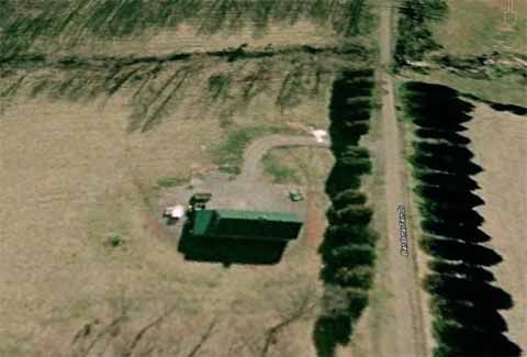 Tracks in the grass/hay 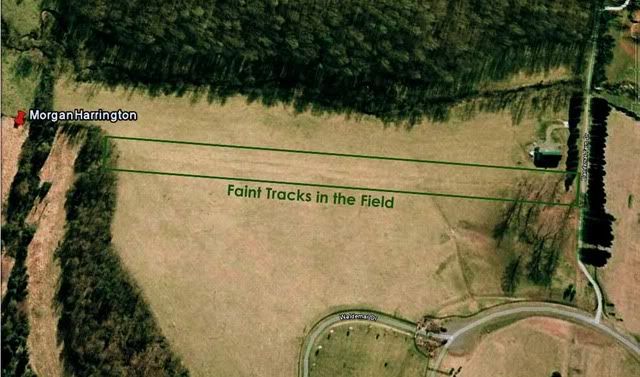 Distance between the farmhouse and Morgan location. 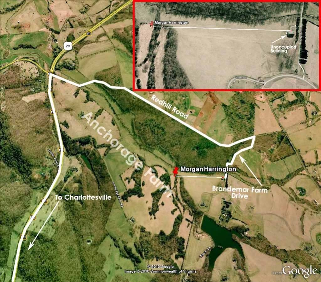 |
|
|
|
Post by Jester_ on Feb 17, 2010 23:11:27 GMT -7
Charlottesville, Virginia Aerial View: Charlottesville Copley Bridge, where Morgan was last seen hitchhiking, to body location. 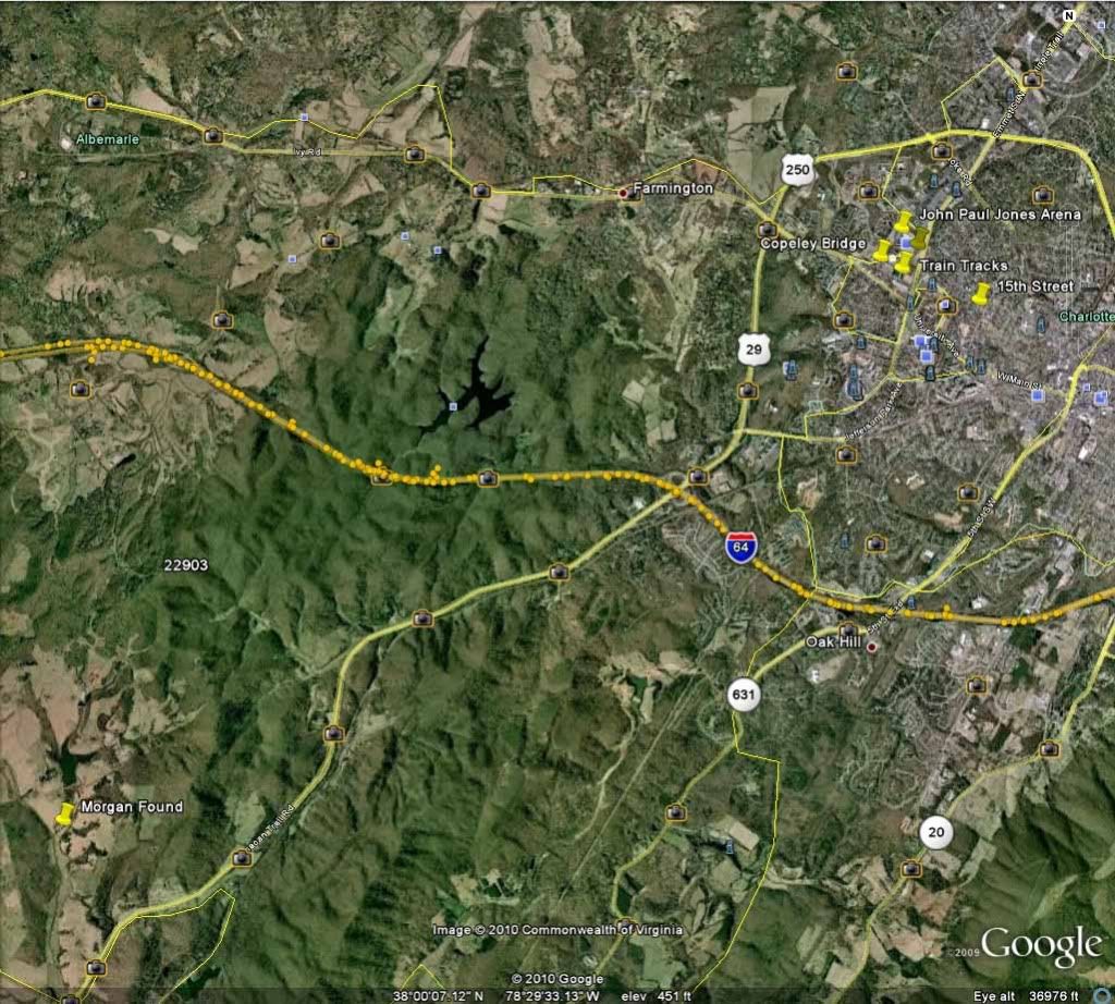 Terrain 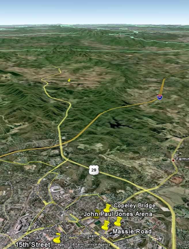 |
|
|
|
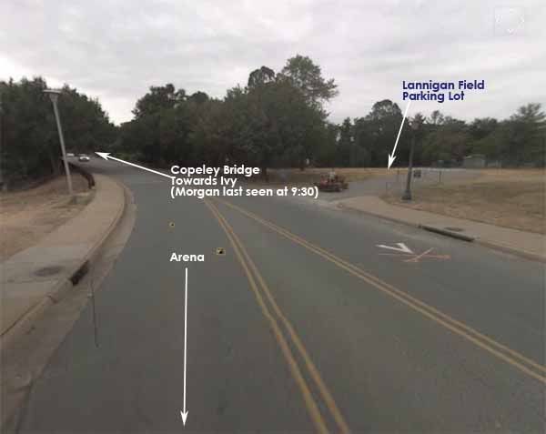
Post by Jester_ on Feb 17, 2010 23:12:19 GMT -7
Relationship between Arena, where Morgan was last seen, and a similar shirt that was found. Last seen: Arena Shirt found: 15th 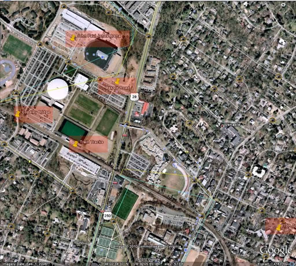 The area where the shirt was found 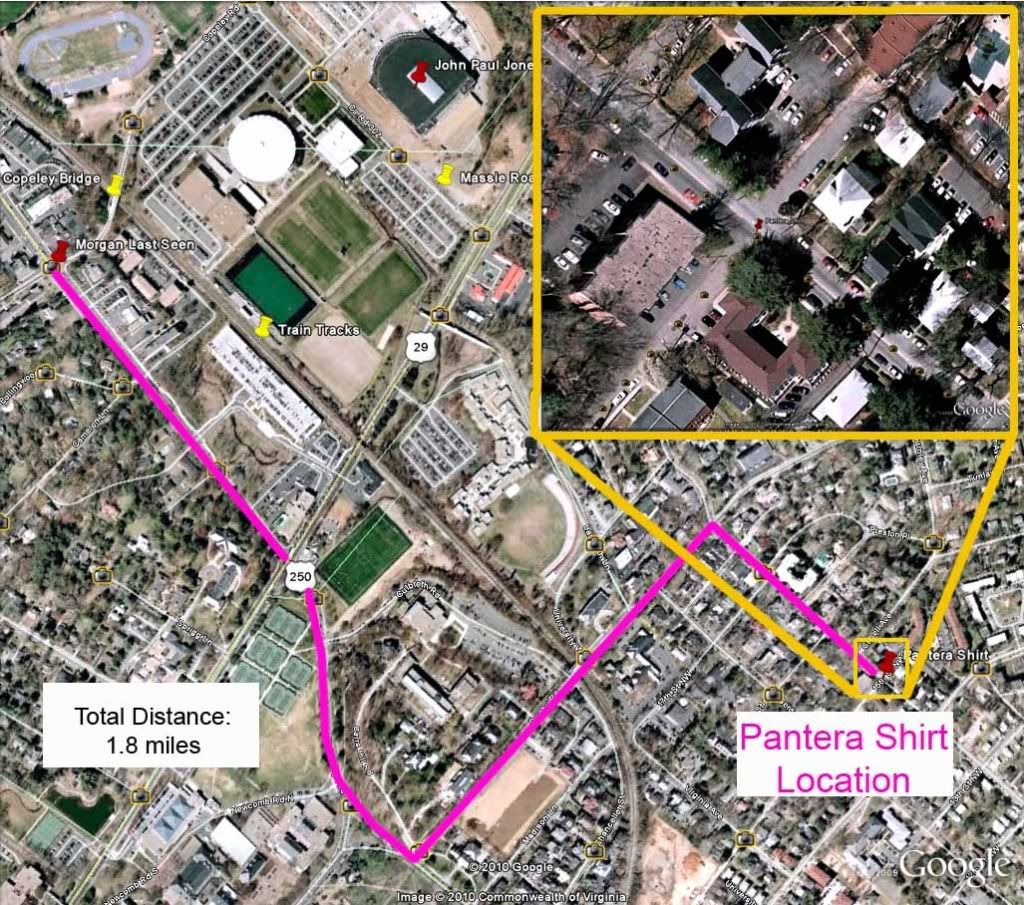    |
|
|
|
Post by Jester_ on Feb 17, 2010 23:15:42 GMT -7
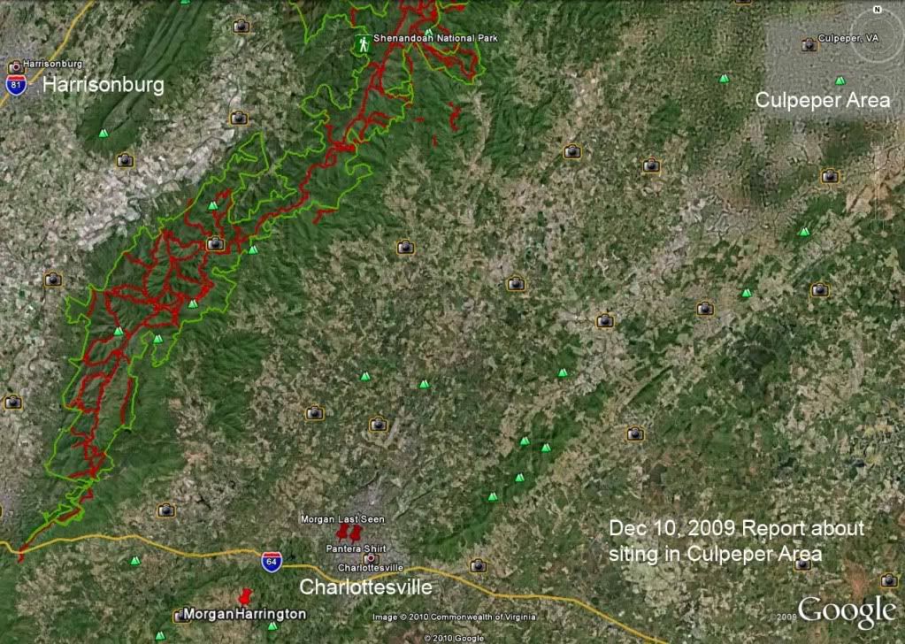
From one of the TV stations ... timeline 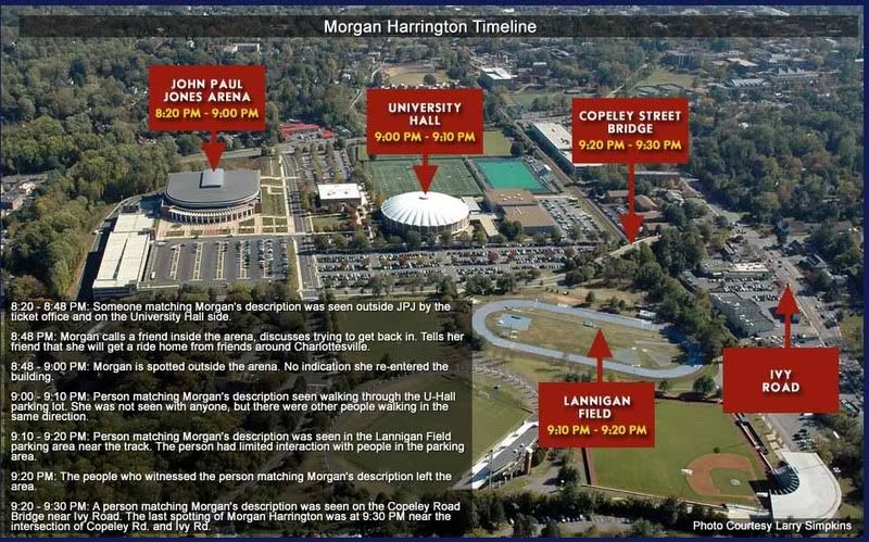 |
|
|
|
Post by Jester_ on Feb 17, 2010 23:17:18 GMT -7
Path taken 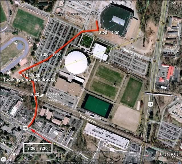 |
|
|
|
Post by Jester_ on Feb 17, 2010 23:23:36 GMT -7
|
|
|
|
Post by Jester_ on Feb 17, 2010 23:31:12 GMT -7
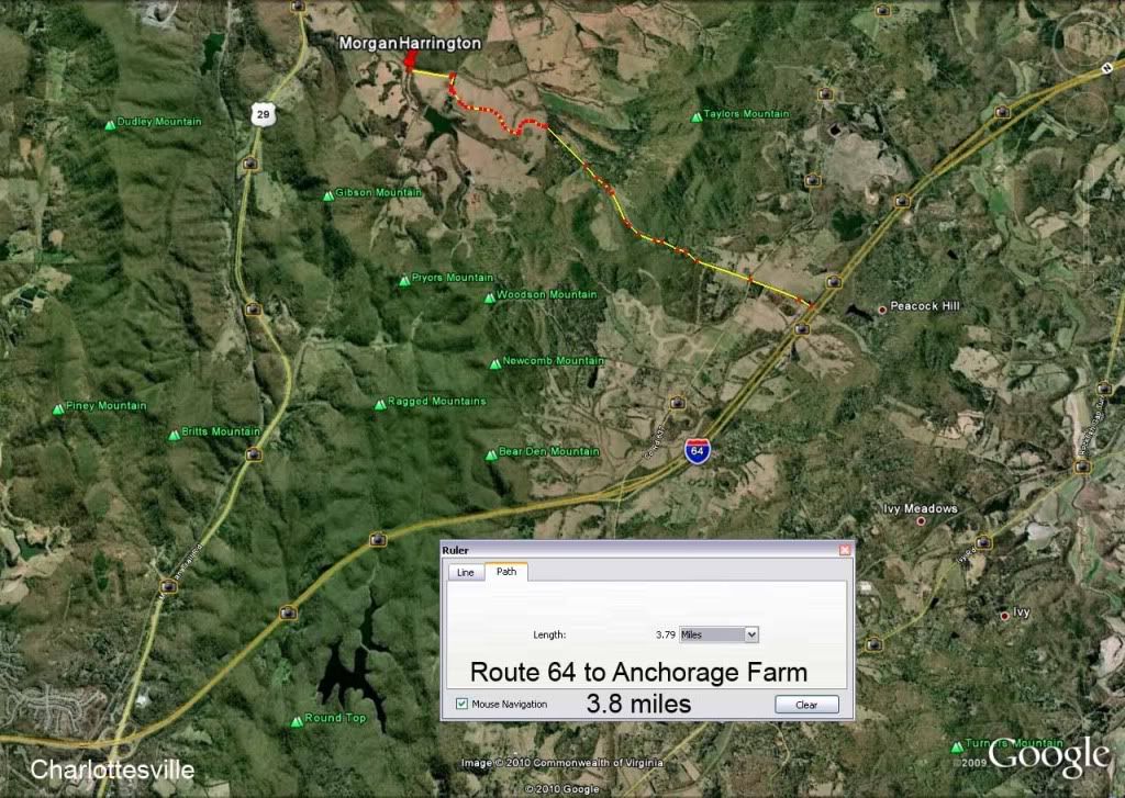
Distance from where Morgan was found to Route 64. 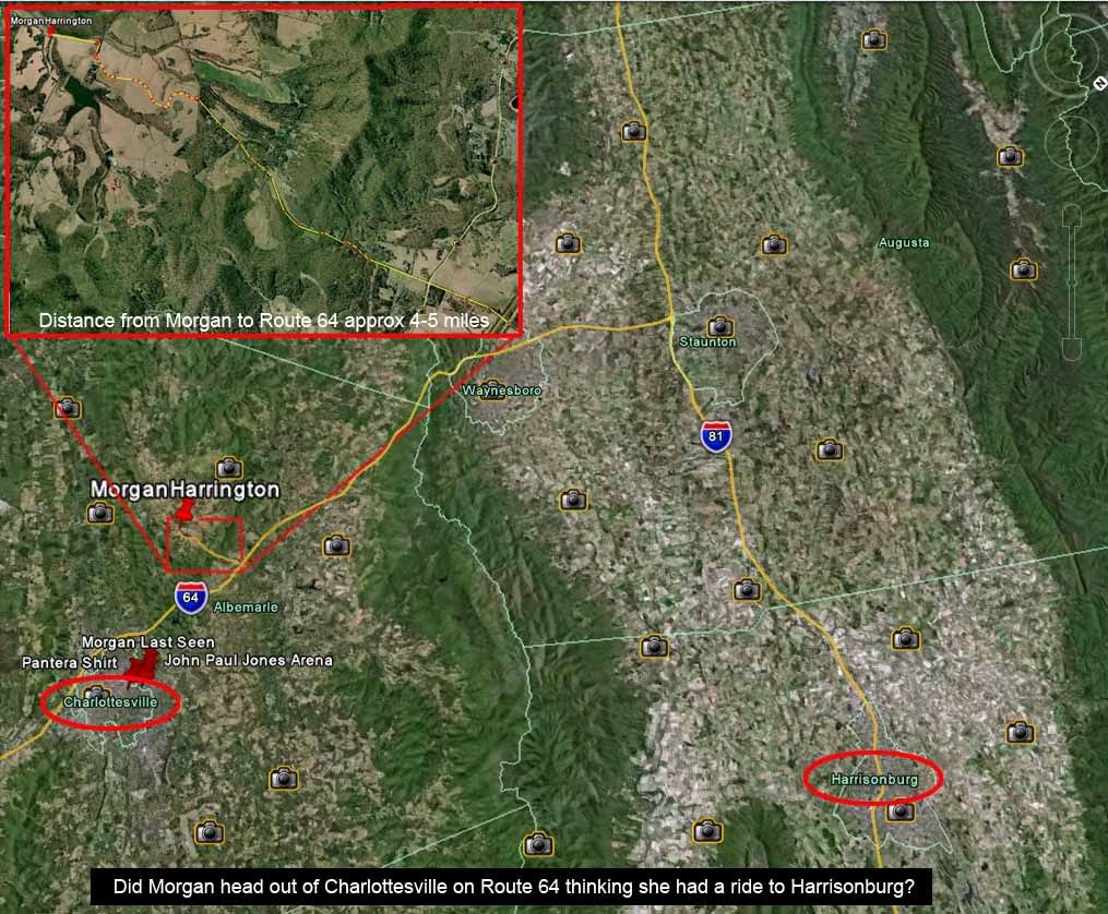 |
|
|
|
Post by Jester_ on Feb 17, 2010 23:33:11 GMT -7
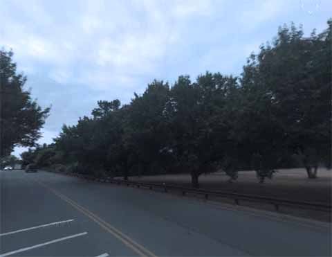
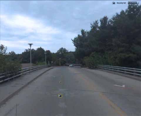
Where Morgan was hitchhiking in relation to Route 64. She lived in Harrisonburg, and had told friends that she would find a ride home with friends. She was later seen wandering through the parking lots, somewhat under the influence, and hitchhiking on the corner of Ivy and Copley Bridge 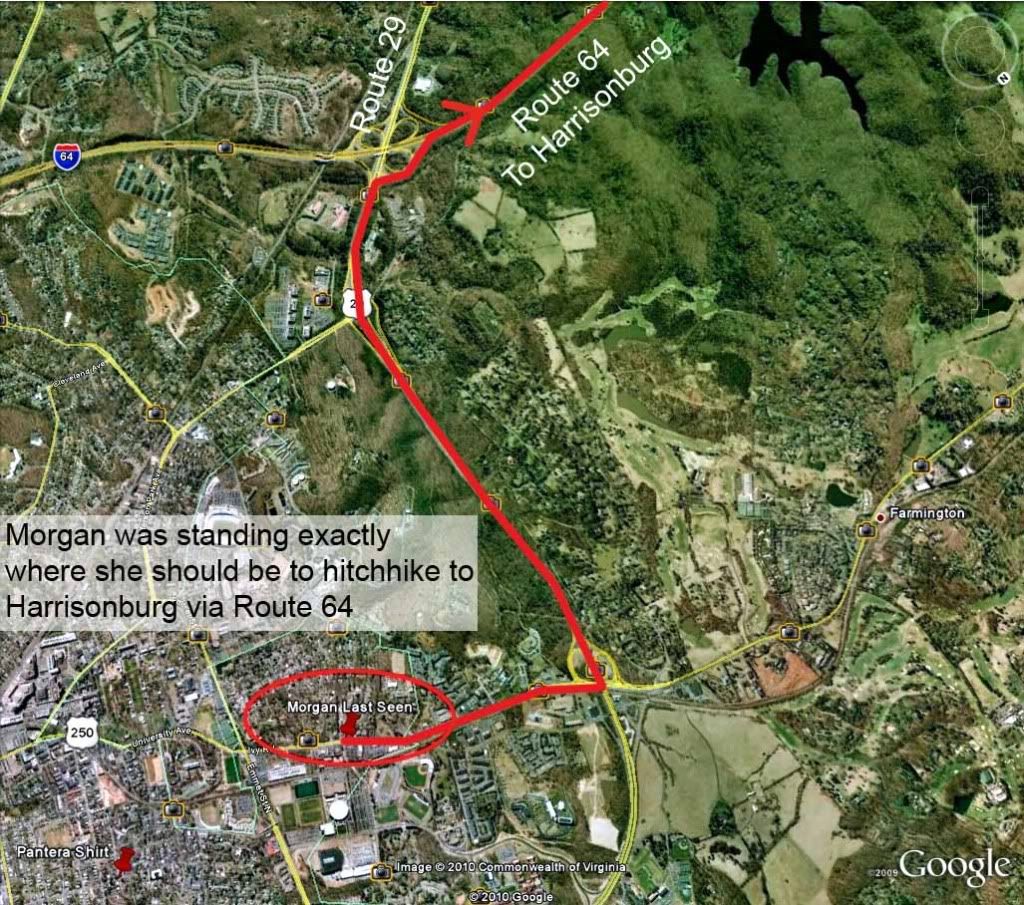 |
|
|
|
Post by Jester_ on Feb 17, 2010 23:35:53 GMT -7
|
|
|
|
Post by Jester_ on Feb 17, 2010 23:36:14 GMT -7
|
|
|
|
Post by Jester_ on Feb 17, 2010 23:39:18 GMT -7
Redhill Road is along the bottom of the illustration. Entering the property from Redhill Road, near the subdivision. This could be a dry creek, or a small creek. 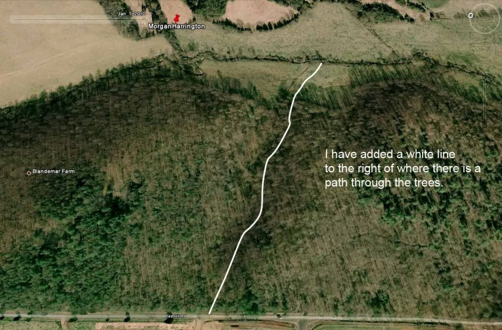 |
|
|
|
Post by Jester_ on Feb 17, 2010 23:40:33 GMT -7
Partial aerial view: Redhill Road. 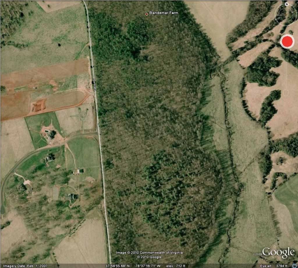 Close up of the subdivision west of Redhill Road. 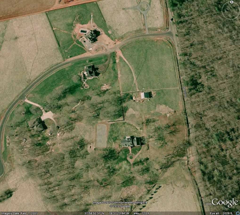 New construction in subdivision west of Anchorage Farm 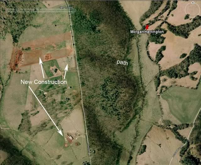 |
|